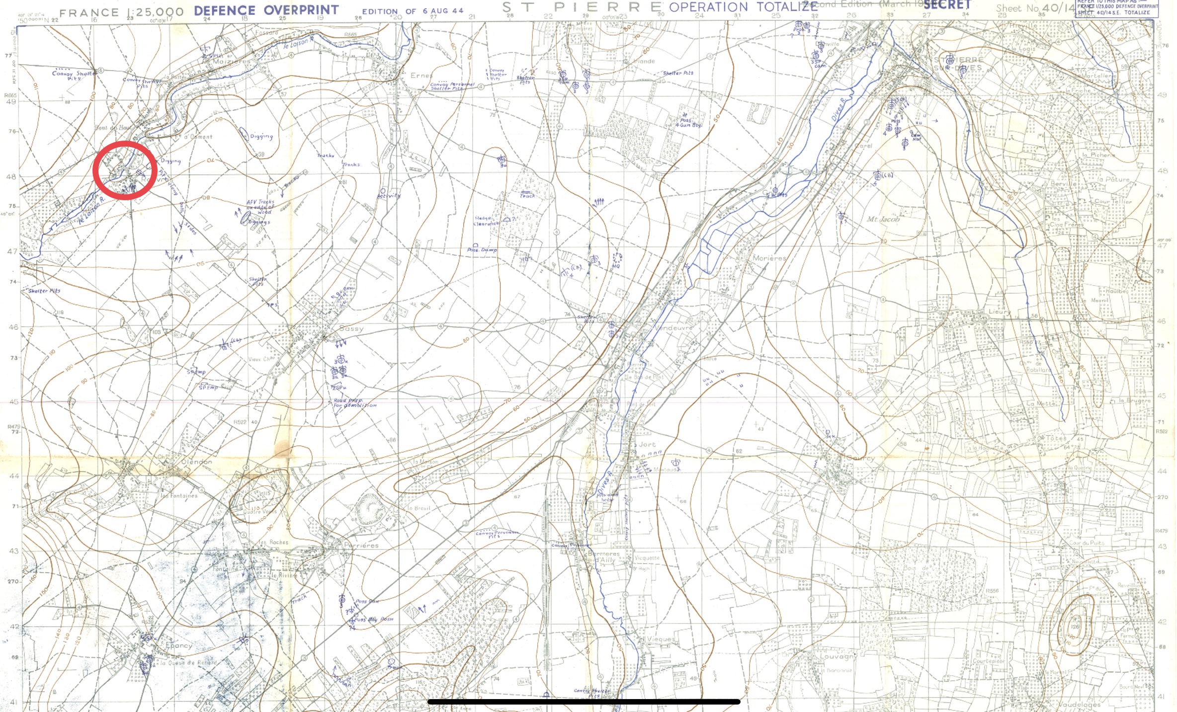
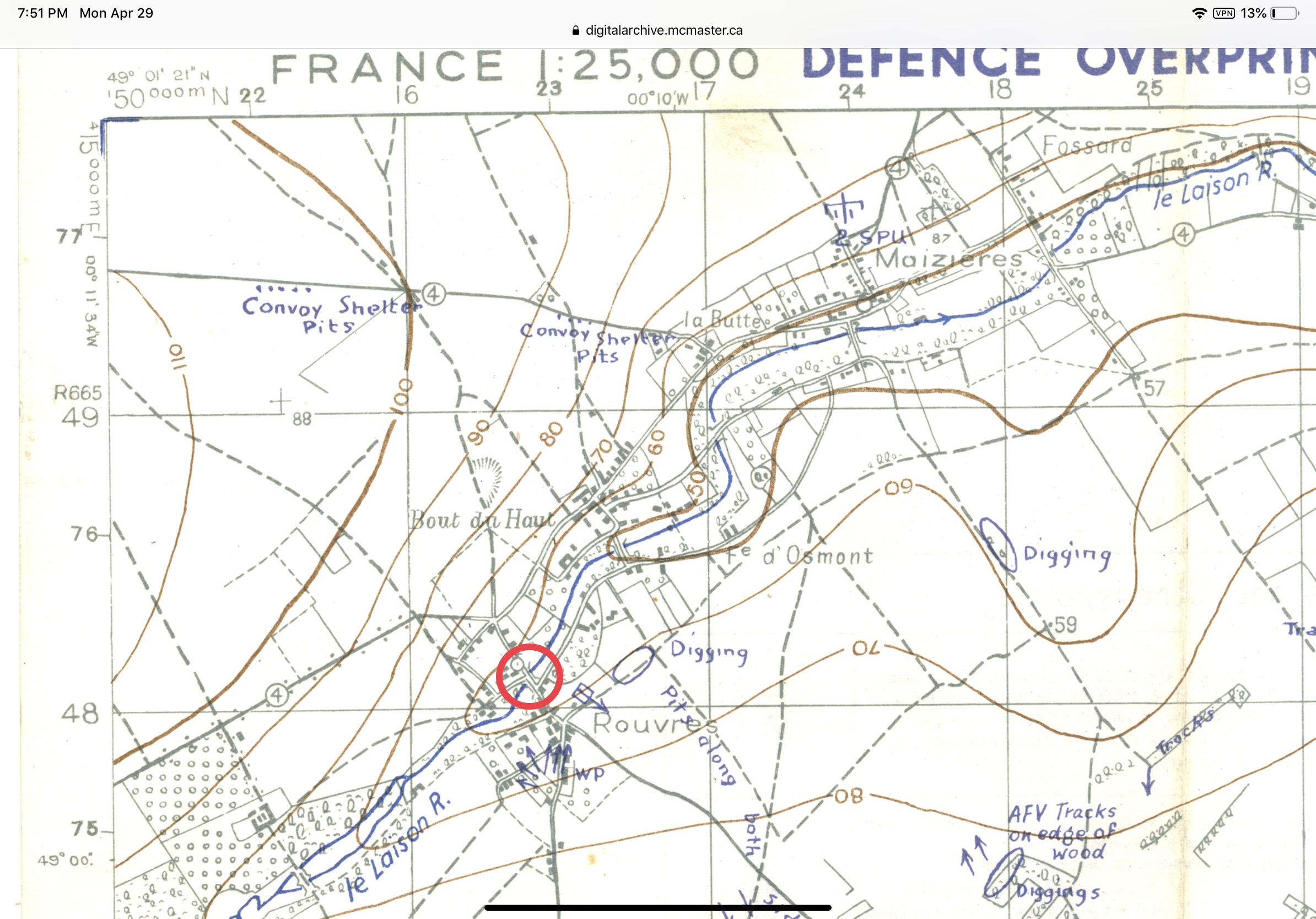
After finding and posting the above information.......I starting wondering, “where was this bridge”..........so found the proper map Sht 40/14 SE and using the Map Reference 164 481, found the location.
First map is “full size” and the location in the red circle

- 8C620F4A-8B32-4CB4-B2CD-28A4537B85E1.jpeg (1.44 MiB) Viewed 13075 times
Second map, is zoomed in on the Map Reference, and you can see the civilian bridge, over the River Laison, where they constructed a “single wide, single height” Class 40 bailey. After construction this bridge stood up to 600 vehicles an hour crossing it
[/size]

- 310AE138-578B-4844-A40F-1F3600912386.jpeg (676.57 KiB) Viewed 13074 times