21 Aug 44
- A2299899-3CBF-4454-A2A3-0382889A6DAD.jpeg (285.69 KiB) Viewed 24865 times
COMMENTS: OK, this is were it “starts” to get confusing. HQ’s orders them to proceed with a 130 Foot long bridge, CLASS 18.....I am confused if this is the SAME bridge they have been talking about in previous days OR a NEW bridge. My “gut” tells me it’s the SAME bridge.....again, they give no Map Reference, so I don’t know where it is. They keep saying Troarn, but this could just mean the “vicinity of Troarn”......or maybe it IS IN TROARN as it says “bridge river”......and the river GOES THRU TROARN.........note: later when they are working on other bridges, these are shorter, as they are only bridging canals.
Anyway, because of the length, 130 feet, in order to “stay up” it needs to be a Triple Single (three panels wide, one row high) bridge which makes it “weight bearing capacity” a Class 30.
Now looking again at the Dairy, I know they built a CLASS 30 right from the start.
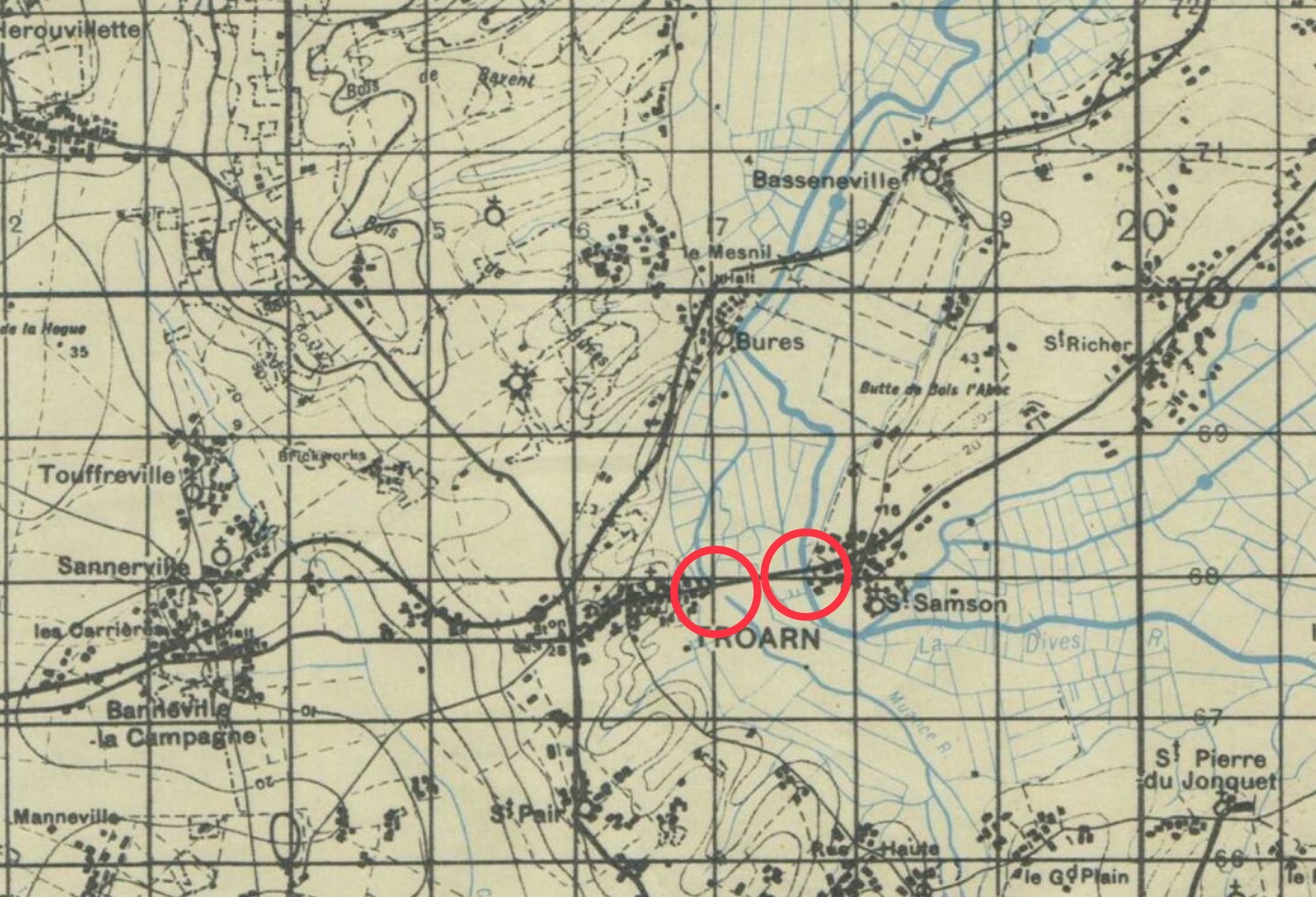
This map shows TWO possible locations of the above bridge, I THINK its the second circle, closer to Samson, as this is the RIVER, the other seems to be a canal or smaller tributary
- F941784E-DC1A-4A02-90B2-84CF769B324B.jpeg (444.04 KiB) Viewed 24862 times


