An excellent source for downloadable trench maps is here: http://library.mcmaster.ca/maps/ww1/home.
Also at this page are guides for finding locations on the maps from grid references available in Battalion War Diaries.
Moderator Added Information
In addition to the information posted above by BFBSM, another source of trench maps is the National Library of Scotland located here: https://maps.nls.uk/ww1/trenches/
On the screen that opens, on the left side, go to “choose a map series” and Select the first item “select a category” and finally “scroll down” to Belgium/France Trench Maps
Trench Maps
Re: Trench Maps
AFTER, finding your co-ordinates, and the Trench Map........you may wish to “find” that point on todays modern maps (either for information, or to physically visit the site)
The link below is a Trench Map Co-ordinate Converter.......by putting the WW1 trench map reference into this tool, it will find the “approximate” point on todays modern maps. Of course the point may now be below a parking lot, or in the middle of a city, but it allows you to find the point.
It does take “practice” to use the Converter, as you do need the Map number etc, but the site gives explanations on how to use it.
OR, please feel free to return to this site, and we can help you with both the original Map Reference and finding the reference on “todays maps”
http://rdf.muninn-project.org/TrenchCoordinates.html
Re: Trench Maps
Below is an example of a Trench Map.....then some positions located on that map.....and finally using the Trench Map Conversion tool to find the location on a modern map
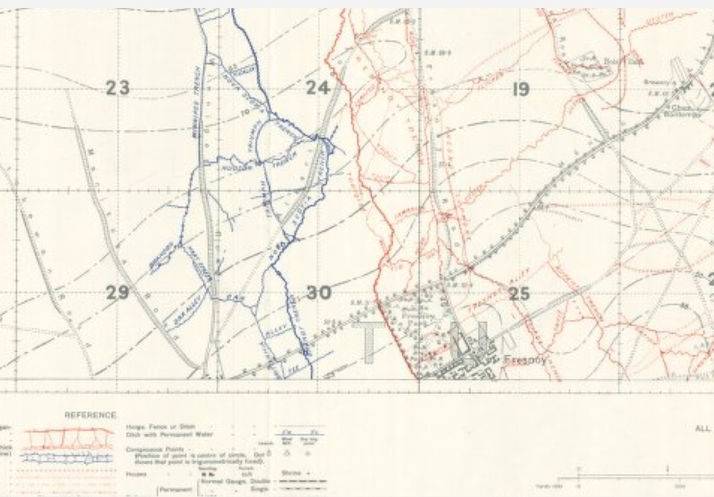
WW1 Trench Map
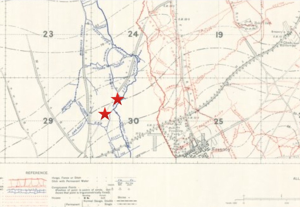
Location of two map reference points on the Trench Map (info is from War Diaries of unit)
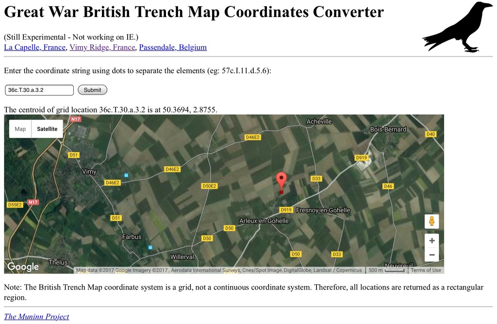
Using the Trench Map Convertor in the post above, the location of the point on a modern map

WW1 Trench Map

Location of two map reference points on the Trench Map (info is from War Diaries of unit)

Using the Trench Map Convertor in the post above, the location of the point on a modern map
Re: Trench Maps
The following is an example of how I researched a specific soldier for a Family. First, using LAC I found his “Circumstances of Death” registry. This gave me a clue on the area in was Killed in. I then looked up the Unit war dairies for the date, and found his name in the diaries (this is unusual, as “soldiers” names are not usually mentioned in the war diaries) BUT the reason I was looking in the war diaries was to find the location of the Unit on that day, which is usually given by Map Reference.
Using the Map Reference, I then looked for the specific map at the Univeristy of McMaster’s WW1 Trench Map site, finding the correct map I then “located” the position on the trench map.
Finally, after locating the position, I used the “trench map convertor” to convert the postion to a “modern map”. On comparison to the WW1 Trench Map and the Modern Map....you can see that the position is still identifiable beside the old railroad tracks.
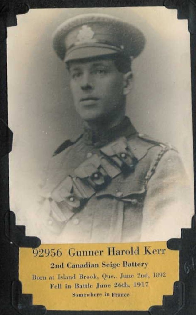
Original Family Info
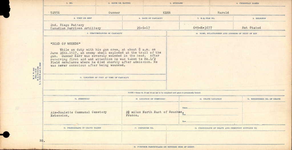
Circumstances of Death Record from LAC
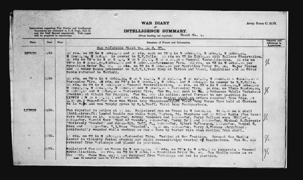
Unit War Diary for appropriate day, from LAC
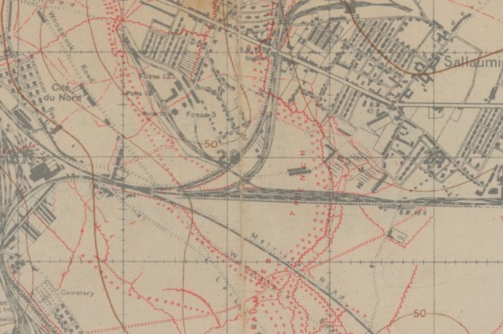
WW1 Trench Map from McMasters University
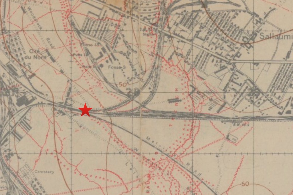
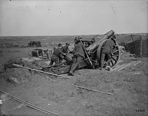
Location of Battery on Trench Map
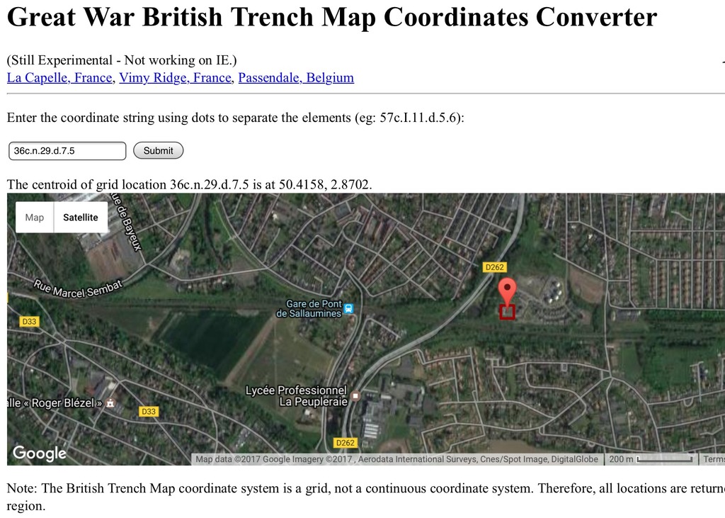
Location of Battery on modern map
Using the Map Reference, I then looked for the specific map at the Univeristy of McMaster’s WW1 Trench Map site, finding the correct map I then “located” the position on the trench map.
Finally, after locating the position, I used the “trench map convertor” to convert the postion to a “modern map”. On comparison to the WW1 Trench Map and the Modern Map....you can see that the position is still identifiable beside the old railroad tracks.

Original Family Info

Circumstances of Death Record from LAC

Unit War Diary for appropriate day, from LAC

WW1 Trench Map from McMasters University

Location of Battery on Trench Map

Location of Battery on modern map

Re: Trench Maps
How to Read Map Reference Numbers:
The diagram below represents the grid on a typical World War I map at a scale of 1:40,000.
The Map is divided into 24 lettered squares labelled A to X.
We will use the following map reference number as an example:
28.U.22.C.3.2.
The first number in the reference pertains to the map sheet number "28".
Note:
Sheet numbers can also contain letters, as in sheet number "36cNW1" at 1:10,000 scale. (The sheet number would then look like 36cNW1.U.22.C.3.2.)
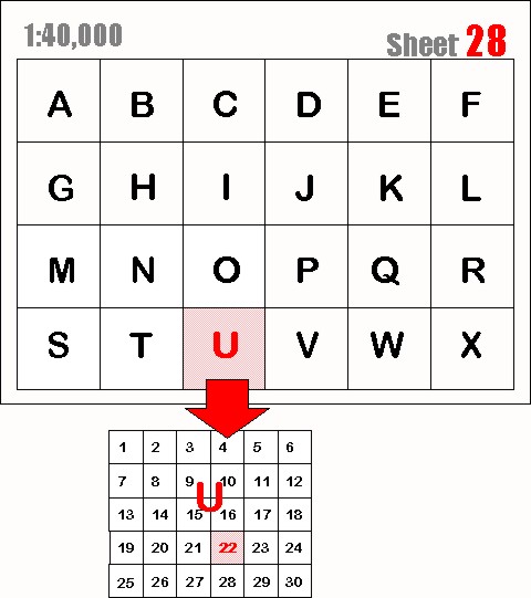
Next, follows the first letter which refers to the grid square "U" on that sheet. 28.U.22.C.3.2
Each lettered grid square is then divided into smaller squares numbered from 1 to 30 (in some cases 1 to 36).
In this example, the square number "22" is indicated in the map reference. 28.U.22.C.3.2.
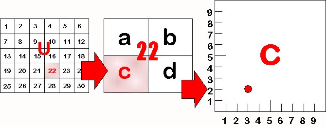
This square 22 is then further divided into 4 squares labelled "a", "b", "c" & "d".
In this example we have used the letter "C". 28.U.22.C.3.2.
Finally, square U.22.C. can be even further divided into tenths.
On a 1:10,000 scale map you will actually see small division lines like those in the diagram below.
The first number is read from left to right.
In this example the number is "3" so, our reference point is 3 tenths from the left. 28.U.22.C.3.2.
Our second number is read from the bottom of the square up.
In this example it is a "2" so, our point is also 2 tenths up from the bottom. 28.U.22.C.3.2
http://library.mcmaster.ca/maps/ww1/MapRefNo
The diagram below represents the grid on a typical World War I map at a scale of 1:40,000.
The Map is divided into 24 lettered squares labelled A to X.
We will use the following map reference number as an example:
28.U.22.C.3.2.
The first number in the reference pertains to the map sheet number "28".
Note:
Sheet numbers can also contain letters, as in sheet number "36cNW1" at 1:10,000 scale. (The sheet number would then look like 36cNW1.U.22.C.3.2.)

Next, follows the first letter which refers to the grid square "U" on that sheet. 28.U.22.C.3.2
Each lettered grid square is then divided into smaller squares numbered from 1 to 30 (in some cases 1 to 36).
In this example, the square number "22" is indicated in the map reference. 28.U.22.C.3.2.
This square 22 is then further divided into 4 squares labelled "a", "b", "c" & "d".
In this example we have used the letter "C". 28.U.22.C.3.2.
Finally, square U.22.C. can be even further divided into tenths.
On a 1:10,000 scale map you will actually see small division lines like those in the diagram below.
The first number is read from left to right.
In this example the number is "3" so, our reference point is 3 tenths from the left. 28.U.22.C.3.2.
Our second number is read from the bottom of the square up.
In this example it is a "2" so, our point is also 2 tenths up from the bottom. 28.U.22.C.3.2

http://library.mcmaster.ca/maps/ww1/MapRefNo
Re: Trench Maps
Another excellent site for WW1 maps (I had mentioned this site in the first post). The “bonus” about this site, is once you find the correct WW1 Trench map and coordinates, the map is OVERLAID on a “today’s map”.........and using the tools, you can go from the WW1 Trench map to a modern day map right below it. Excellent source to find modern day location without all the work on the posts above
Site, is the National Libraries of Scotland
https://maps.nls.uk/geo/explore/#zoom=1 ... 464999&b=1’’
Below are screen shots of the website.
This shot shows a WW1 Trench Map overlaid on a “modern map”
In this screen shot, I have “zoomed in” to show you the WW1 Map in a larger format
This is the “same” screen shot above, but I’ve used the “tool” on the bottom left of the screen to make it “translucent” (about 50%) and you can see the modern day map “appearing” below
And finally, I have made the WW1 “disappear” and you can see the modern day map which was below the Trench Map
