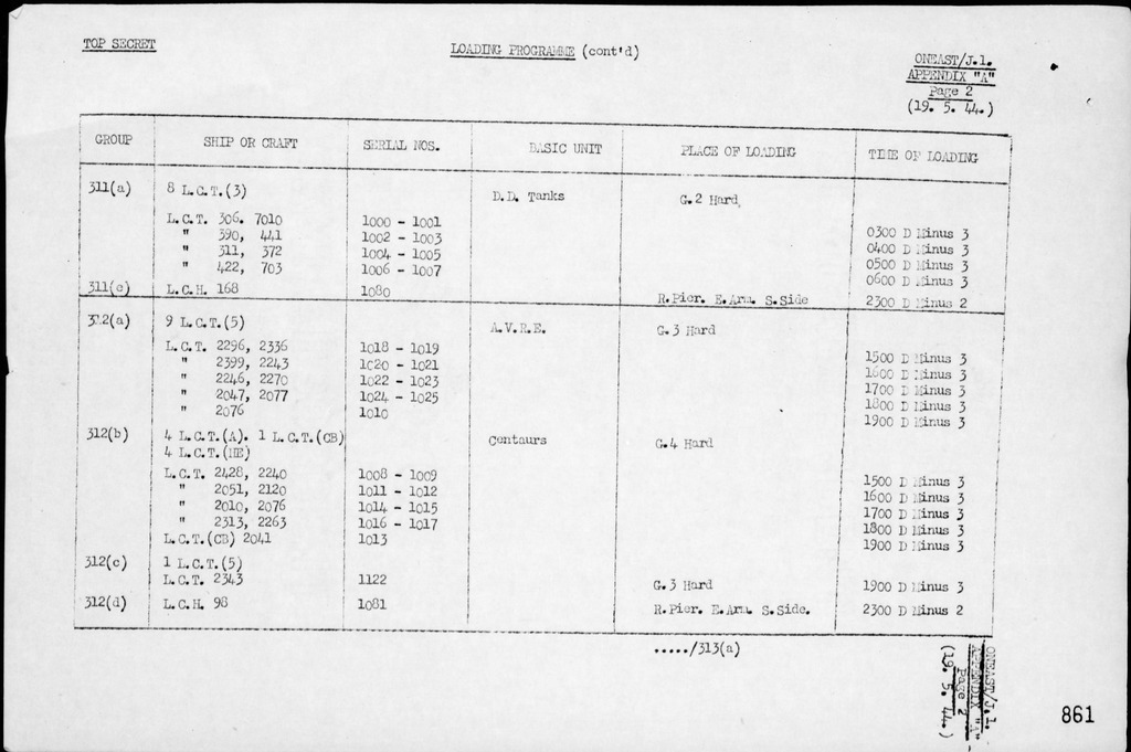
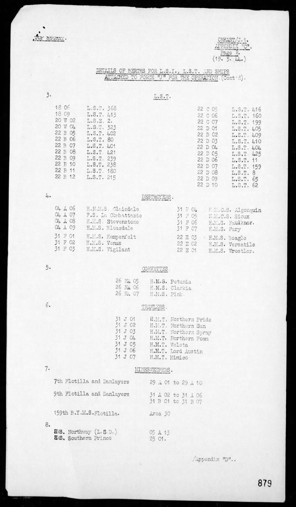
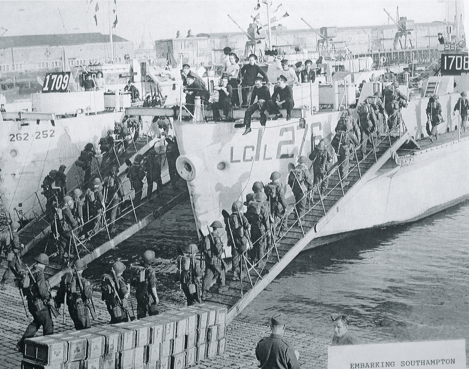
Example of “Loading Information” for Ships and Landing Craft carrying Canadian Troops from Operational Orders - Op Neptune
This chart indicates the Ship or Landing Craft and the place of “loading” troops and/or vehicles. Landing Craft that loaded vehicles were generally loaded at “hards” (beach and harbour area’s that had been prepared to accept Landing Craft”. The Larger Landing Ships Infantry (eg HMS Hilary) were loaded by “tender” (much like todays cruise ships) and moved to the ship by “tender”(which could be some of the ships on board landing craft or other landing craft) to board at the ships mooring point.
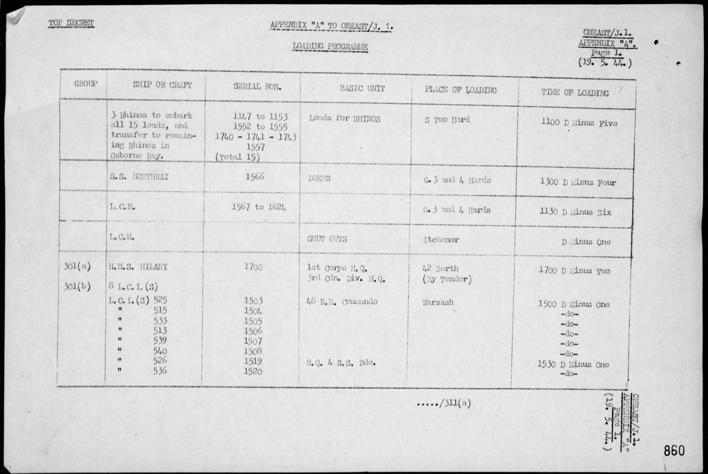
As you can see from the example below, on the Chart the actual Landing Craft Number, eg 2296 is given, then the LTIN (Landing Table Identification Number) eg 1018, then the “type” of vehicles being loaded eg AVRE (Armoured Vehicle Royal Engineers) and finally the loading time and date eg 1500 hour D MINUS 3
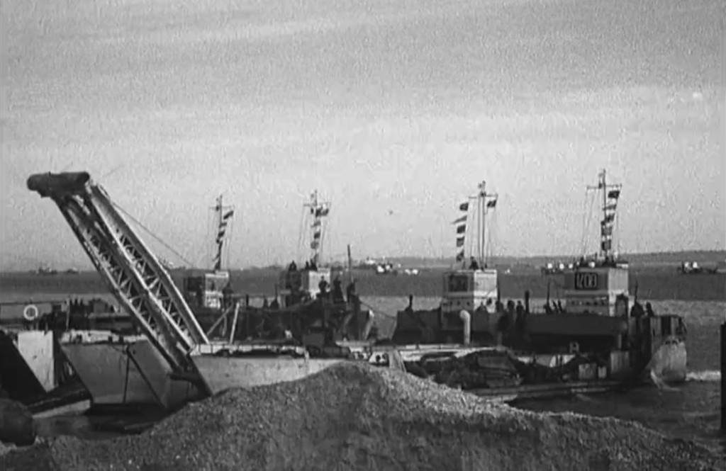
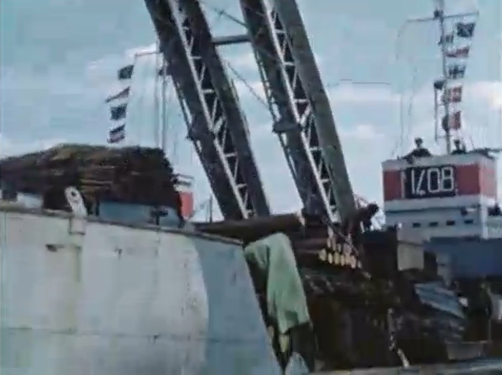
The LTIN number was posted prominently on the SHIP or Landing Craft so that vehicle commanders new which vessel was theirs to load on.
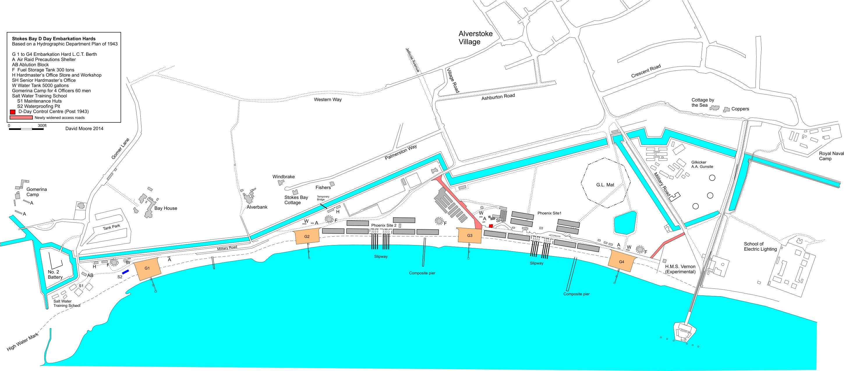
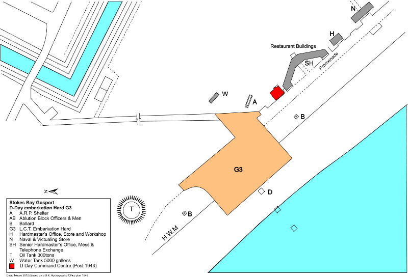
The loading point for the above Landing Craft was G3 HARD......which was in Stokes Bay (see information on next post)
Vehicles had “chalk markings” of the ship and other information chalked on the side eg, the AVRE’s scheduled for the above ship would have a chalked indentification written on it starting with 1018 (the LTIN for this vehicle and vessel)
Also included is the actual CONVOY that the ship or serials of ships were assigned to for the CROSSING